A north-west cloud band brought patchy rain and isolated thunderstorms from northern Western Australia across central and southern Northern Territory to south-eastern New South Wales.
 A low pressure system and its associated cold front moved across south-eastern South Australia and into New South Wales triggering widespread rain.
Cold fronts and low pressure troughs led to rainfall in parts of Western Australia and Tasmania.
Moist easterly airflow brought several days of showers to parts of north-eastern Queensland.
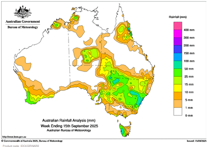
Weekly rainfall totals between 50 and 100 mm were recorded in western Tasmania and large parts of New South Wales, with totals exceeding 100 mm in coastal areas of Hunter, Sydney Metro and Illawarra districts.
Weekly rainfall totals between 10 and 50 mm were recorded across most of New South Wales and western Tasmania, parts on northern and south-western Western Australia, northern and southern Northern Territory, eastern South Australia, north-eastern and southern Queensland, and small areas of Victoria.
The highest weekly total (at a Bureau gauge) was 169.4 mm at Randwick (NSW), and the highest daily total was 161.6 mm at Culburra Treatment Works (NSW), in the 24 hours to 9 am on 11 September.