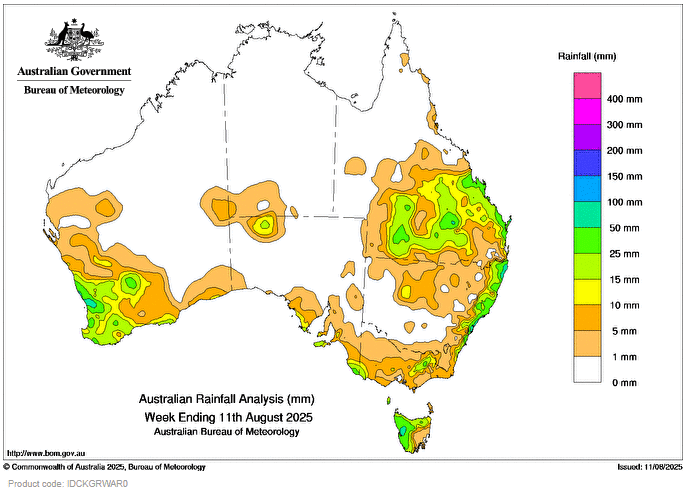
AN UPPER low pressure trough crossed central Australia, southern Queensland and northern New South Wales. It combined with moist onshore airflow leading to showers, widespread rainfall and storms across parts of these regions.
An offshore trough brought showers along the coastal fringe of New South Wales on 9 and 10 August.
 Weekly rainfall totals of 15 to 50 mm, with locally higher totals up to 150 mm, were recorded across central and southern Queensland, most of coastal New South Wales and an isolated pocket in northern South Australia.
Cold fronts and associated troughs led to scattered rainfall and storms, some severe, across south-western Western Australia, southern parts of South Australia, Victoria and Tasmania.
Weekly rainfall totals of 15 to 50 mm, with locally higher totals up to 100 mm, were recorded across south-west Western Australia, isolated parts of the south-eastern South Australia, parts of western and eastern Victoria and much of Tasmania.
The highest weekly total (at a Bureau gauge) was 145.8 mm at Lady Elliot Island in Queensland which included the highest daily total of 80.6 mm in the 24 hours to 9 am on 10 August.
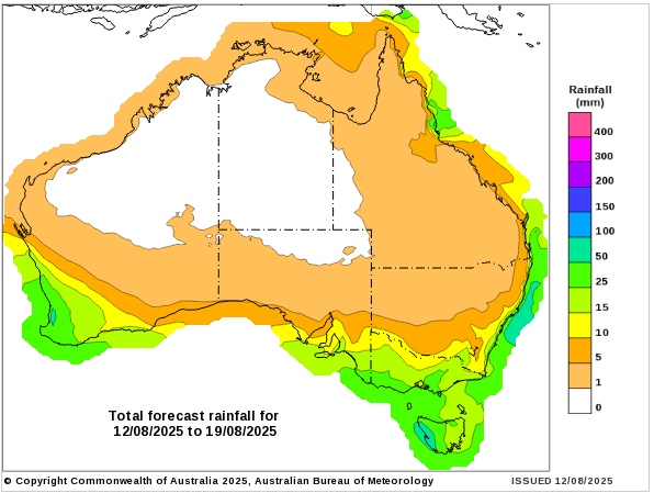
Does anyone know what happened to the GFS (Global Forecasting System) which was also used here for what was expected in the way of precipitations?
Always been quite reliable and easy to understand.