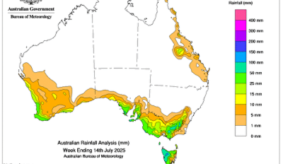
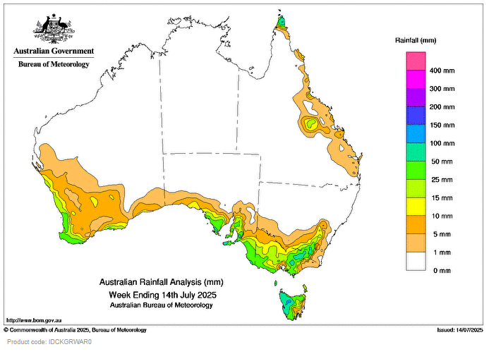
COLD fronts and associated troughs led to scattered rainfall and storms across south-western parts of Western Australia, south-eastern regions of South Australia, southern New South Wales, Victoria and Tasmania.
Weekly rainfall totals of 25 to 100 mm were recorded across the south-west and southern parts of Western Australia, south-eastern regions of South Australia, including the Adelaide Hills, most of Tasmania, south-western Victoria and alpine regions of Victoria and New South Wales.
Most of central and northern Australia did not record any rain during the week with conditions typical of the dry season.
The highest weekly total (at a Bureau gauge) was 100.1 mm at Piccadilly (Woodhouse) in South Australia, which included the highest daily total (at a Bureau gauge) of 73.4 mm in the 24 hours to 9 am on 10 July.
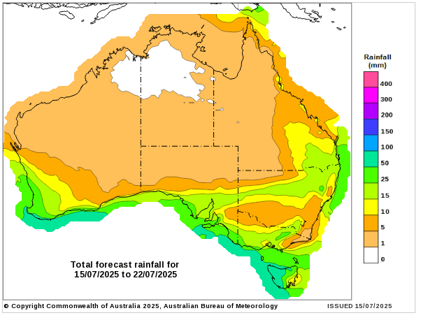
What happened to the GFS forecasting maps we all relied on for so long, which were very reliable?